From the wildlife of Etosha to the dunes of Sossusvlei and the culture of Kaokoland — explore the places your Atutanga journey can take you.
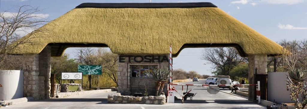
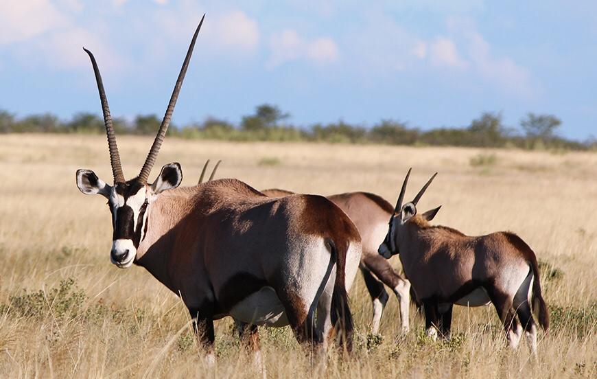
Etosha National Park lies in northern Namibia and is a premier wildlife reserve in Southern Africa, covering about 22,270 km² — home to 114 mammal species including the big four (lion, leopard, rhino & elephant), plus plains game like zebra and antelope, small predators and over 330 bird species. You can also find species endemic to northern Namibia such as the Black-Faced Impala and the smallest antelope, the Damara Dik-Dik.
The park consists mainly of saline desert, savannah and woodlands. Its dominant feature is the Etosha Pan, which measures 130 km in length and up to 50 km wide in places — a shimmering spectacle that provides excellent photographic opportunities. Dry for most of the year, the pan floods temporarily in the rainy season, becoming home to thousands of pelicans and flamingos.
Animals rely on man-made waterholes, and during the dry season (May–September) these attract a wealth of species — elephants, giraffes, lions, hyenas, springbok and zebra all drinking together, a sight you don't see in many other parts of Africa. Game viewing is best in the dry season when the bush is clear.
View on Map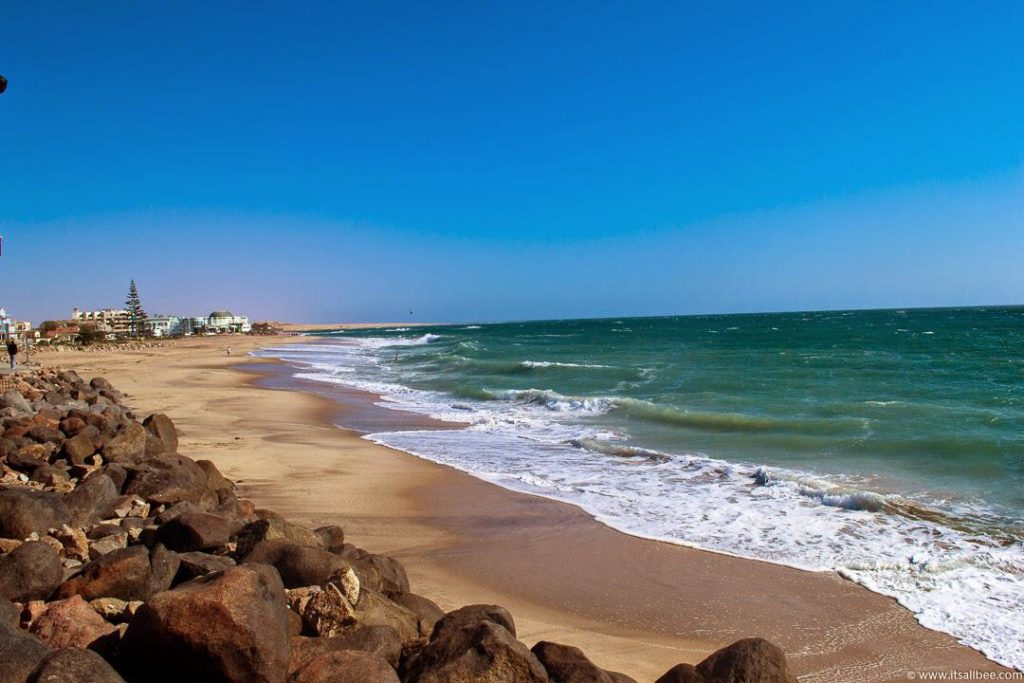
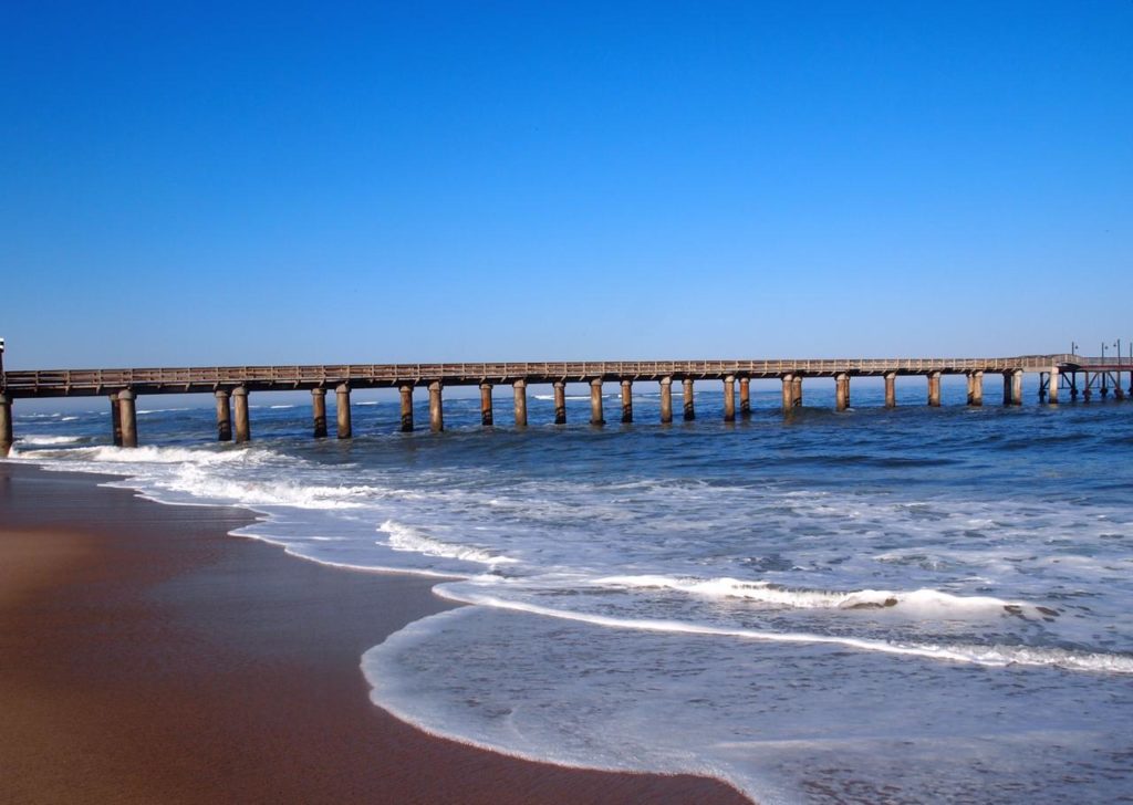
Swakopmund sits on the Namibian coast and is a premier holiday resort. The cool coast offers relief from the heat of the interior, making it the most preferred summer destination for many locals. This is an adventure and recreation town with a wide range of activities to suit all ages.
The name Swakopmund combines two words from two tribes — Nama and German. 'Swakop' (Nama) refers to the river that reaches the sea at the town, while 'mund' (German) means 'mouth' — together, the mouth of the Swakop. During floods the Swakop River collects and transports mud, vegetation and debris to the sea.
View on Map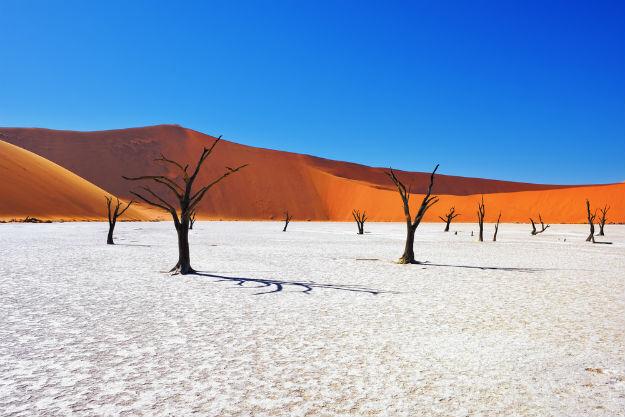
Sossusvlei lies in the Namib Desert, one of the oldest deserts in the world. It is a small salt pan surrounded by sand dunes — Namibia's scenic highlight, situated 65 km from Sesriem in the Namib-Naukluft Park. The dunes form part of the Namib Sand Sea, a declared World Heritage site.
The spectacular red colour of the dunes results from the high iron content in the sand, oxidising over the years. The name Sossus means 'a place where water collects', and vlei is Afrikaans for 'pan'. Nearby lies Dead Vlei — 'dead marsh' — surrounded by some of the world's highest dunes, reaching over 400 m.
Dead Vlei's acacia trees died when the Tsauchab River was cut off by the dunes some 900 years ago. Scorched black by the sun, these 1,000-year-old trees form a barren forest that makes for stunning photography.
View on Map
Kaokoland is home to the semi-nomadic Himba tribes of Namibia. If you like extreme terrain, hidden valleys and rare, exotic culture, then this sparsely populated land — the size of Switzerland — between the Skeleton Coast Park and the Kunene River on the Angolan border is the place to go. It has a unique beauty with outstanding mountain scenery.
Kaokoland is also home to amazing flora and fauna, including desert-dwelling elephant, rhino, giraffe and lion. Highlights include the Himba tribes, the Kunene River, Epupa Falls, and the Marienfluss and Hartmann's valleys, with cultural interaction and advanced 4×4 trails.
View on Map
Damaraland is one of the most scenic areas in Namibia — a ruggedly beautiful region offering the more adventurous traveller a real challenge. Here lie prehistoric water courses, open plains and grassland, massive granite koppies and deep gorges.
Highlights include the Brandberg — Namibia's highest mountain and home to the famous 'White Lady' rock painting. 'The fire mountain' is named for the way the setting sun lights its western face. The Brandberg and Spitzkoppe are favourites among climbers and contain a high density of San (Bushman) art, while Twyfelfontein holds one of Africa's most extensive rock-art galleries.
View on Map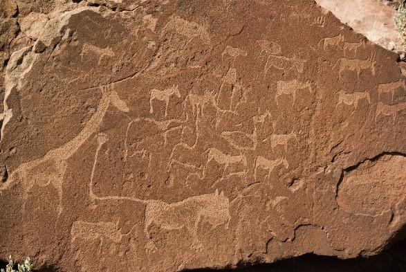
Twyfelfontein — 'doubtful spring' — is a wonderful rocky outcrop with thousands of Bushman engravings, one of the largest concentrations in Africa. Two other well-known geological features nearby are the Organ Pipes and the Burnt Mountain. The Organ Pipes are a distinctive series of dolerite pillars exposed by erosion, viewable in a small gorge. The flat-topped Burnt Mountain takes its name from the blackened limestone at its base.
View on Map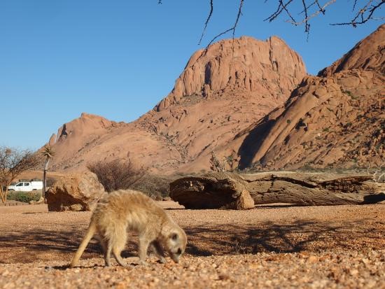
Spitzkoppe — 'sharp head' — is a typical pointed inselberg and a place of great mystery to the ancient San people. One of Namibia's most recognisable landmarks, its shape has earned it the nickname 'The Matterhorn of Africa'. It is the remnant of an ancient volcano, first climbed in 1946 and now a popular destination for local and foreign mountaineers, with plenty of technical climbs available.
View on Map
The Petrified Forest is millions of years old. Its trees were uprooted some 200 million years ago, swept along by floods, covered by sediment and later uncovered by erosion. Local community guides offer insight into the area while ensuring no pieces of petrified wood are removed.
The 35 m-high Vingerklip ('finger rock'), also known as Kalk-Kegel, rises above the Bertram farm — an erosional remnant of a limestone plateau formed over 15 million years ago, first climbed in 1970. A new addition to the area is exciting rhino and elephant tracking safaris, whose proceeds go towards preserving these animals.
View on Map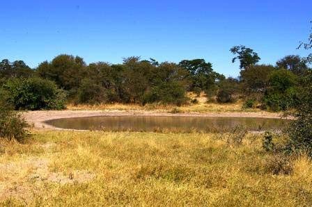
Bwabwata National Park is a protected area in north-eastern Namibia, established in 2007 and covering 6,274 km². It was created by merging the Caprivi Game Park and Mahango Game Reserve, extending along the Caprivi Strip — the northern part of Botswana's Okavango Delta and Chobe regions.
The park has a sub-tropical climate — very hot and humid in summer, with heavy rainfall from November to March. The wettest region in Namibia, it falls into the Tree and Shrub Savanna biome known for wetlands, floodplains and woodlands. Best game viewing is April to September.
Known as the 'people's park', Bwabwata's strong focus on rural development ensures local communities benefit from tourism. Locally managed campsites — Ngoabaca, Nambwa and Bumi Hill — are neat, well-organised and set in spectacular riverside settings.
View on Map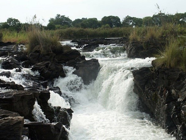
Popa Falls sits on the banks of the Kavango River, which flows into the Botswana Delta. Just 15 km from the Mahango Game Park, it's an ideal base to explore this scenic, remote north-eastern section of Namibia, with its perennial rivers, magnificent woodlands, riverine forests, floodplains and reed-lined channels. Beyond the 'falls' there are good opportunities for hiking and birdwatching — though swimming is not safe, as there are hungry crocs about.
View on MapCall +264 81 674 9583 to book directly or for friendly advice — or send us a message and we'll tailor a trip to your dreams.